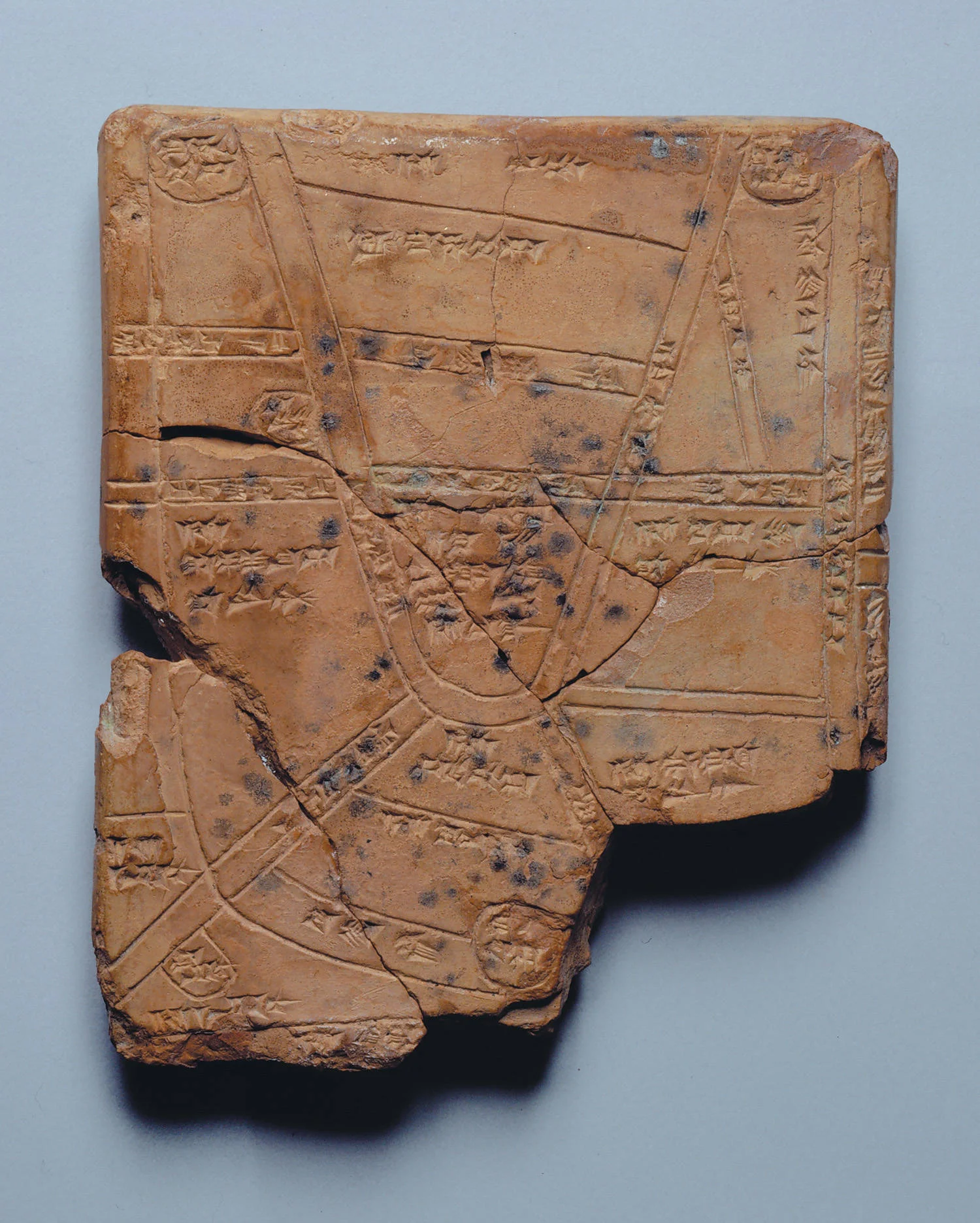
The Oldest Known Map In Existence
Via: penn.museum
The ancient clay tablet above is The Map of Nippur, the oldest known map ever discovered. The cuneiform inscription dates to the 14th - 13th century BC. Imprinted on the tablet face is a map of privately owned fields surrounding the city of Nippur, established in the southern Mesopotamian floodplain, near present-day Diwaniyah, Iraq.
The fields are shown separated by streams and irrigation canals, recorded with the names of the owners. In the center of the map is the king's own field, described as "field between the canals, the holding of the palace."
The University of Pennsylvania collected thousands of clay tablets during four excavations of Nippur from 1889 to 1900. The Map of Nippur was most likely among them, but the significance of the discovery was not recognized until many years later.


